THE MURRAY RIVER PROJECT, 1977
The geological changes are documented by creating grids along the river’s edge at descriptive locations, following the Murray River as it meanders its way west for 2508 kilometres from the Australian Alps, its waters entering the ocean via the Coorong in South Australia.

Near Corryong - a fast flowing mountain stream.

A sample Grid (detail), near Corryong.

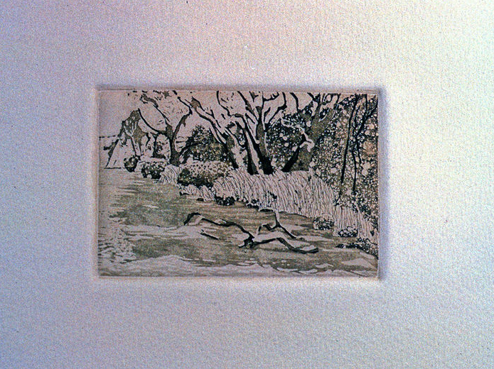
Sample Grid in Yorta Yorta country in the Barmah Forest, west of Albury. The riverbed is a fine, grey clay.

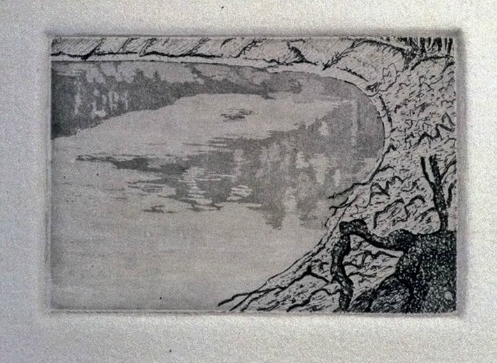
Sample Grid at the Sandbar near Boundary Bend, at the junction of the Murray and Murrumbidgee Rivers.

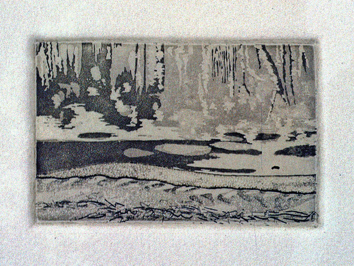
Sample Grid (detail) near Swan Reach, South Australia, where the river has cut its way through rock obstructions, forming steep cliffs full of fossils.

Grid at Lake Alexandrina, South Australia, where the Murray River’s water begins to flow via the Coorong into the Indian Ocean at Encounter Bay.

Murray Rivers Edge, Sandbar near Boundary Bend. Watercolour. 1977
THE MURRAY RIVER, 1979
Mediums, handmade paper, soil, etchings.

1979 Paper Making Summer School at the Tasmanian College of Advanced Education (TCAE), in Hobart: This was followed by an invitation to make a paper work, The Murray River, at the TCAE’s Jabberwocky Paper Mill. I continued the theme of cartography, making a large floor map composed of multiple sheets, and two pressed layers of paper to hold inserts, inscribing the whole of the Murray River. The life cycle theme and the Indigenous history were alluded to with a tiny baby's hand across the river in the mountains & ending with a hand’s skeleton at Lake Alexandrina. Soil from the locations was inserted between the layers. Next to each hand (five), an etching was inserted of the location of the grid from the 1977 field trip along the murray creating grids (see above). The etchings are like photographs on a tourist map or postcard.
These I made with John Loane of Viridian Press in preparation for the paper work. This was shown in 1979 in a travelling exhibition, 15 Sculptors, beginning at the National Gallery of Australia, then on to Benalla Art Gallery, Warrnambool Art Gallery, Hamilton City Gallery, McClelland Gallery, Wollongong Art Gallery, Mildura Art Centre.
Shown in the Adelaide Arts Centre (1983) and Performance Space (1985). Acquired by the Queensland Art Gallery (QAG).

Detail showing an adult’s handprint across the river, the embedded map of the river, the etching imaging the river near Swan Reach, South Australia.
Etching of the river at the Barmah Forest, showing the clay the riverbed.

Etching of the river as a swift flowing mountain stream near Corryong.
Etching: The sandbar near Boundary Bend.
Etching: The river near Swan Reach where it flows along steep cliffs.
Life Is Full of Situations, 1979
Etching. Printed by John Loane, Viridian Press.

1979 Life Is Full of Situations, a coloured etching composed of six plates, the first artwork to come from the field trip described above, for The Map Show, George Paton & Ewing Galleries (GP&EG), University of Melbourne, 1979.
The colour coded plates show:
a satellite image of the river in flood which included the junction of the Murray & Murrumbidgee Rivers;
a C19th survey map for steamship captains, of this section of the river showing three cross sections of the riverbed’s depth, & timber in the vicinity to fire the steam engines’ boilers;
two systematised, map-like images of the facing river banks at the sandbar;
a contour map of a beer can riddled with bullet holes;
the map’s Key.